NDVI and NDMI Observations from Satellites
The heart of our study lies in the insightful observations derived from the satellite data, specifically focusing on two vital indices:
- Normalized Difference Vegetation Index (NDVI)
- Normalized Difference Moisture Index (NDMI).
Normalized Difference Vegetation Index (NDVI):
This fundamental vegetation index offers a window into the health, vitality, and density of plant life within the study area. Calculated from the surface reflectance in the red (RRed) and near-infrared (RNIR) spectral bands, the NDVI values allow us to discern subtle changes in vegetation cover and growth patterns over time.
By utilizing the formula;
NDVI = (RNIR - RRed) / (RNIR + RRed),
higher NDVI values signify flourishing and lush vegetation, while lower values indicate stressed or sparse plant cover.
Normalized Difference Moisture Index (NDMI):
Complementing the NDVI, the Normalized Difference Moisture Index (NDMI) plays a pivotal role in assessing moisture levels within the region. By contrasting the reflectance in the near-infrared (RNIR) and shortwave infrared (SWIR) bands, the NDMI reveals variations in moisture content.
The formula NDMI = (RNIR - R1600) / (RNIR + R1600) enables us to gauge the presence of water stress or abundance in the vegetation.
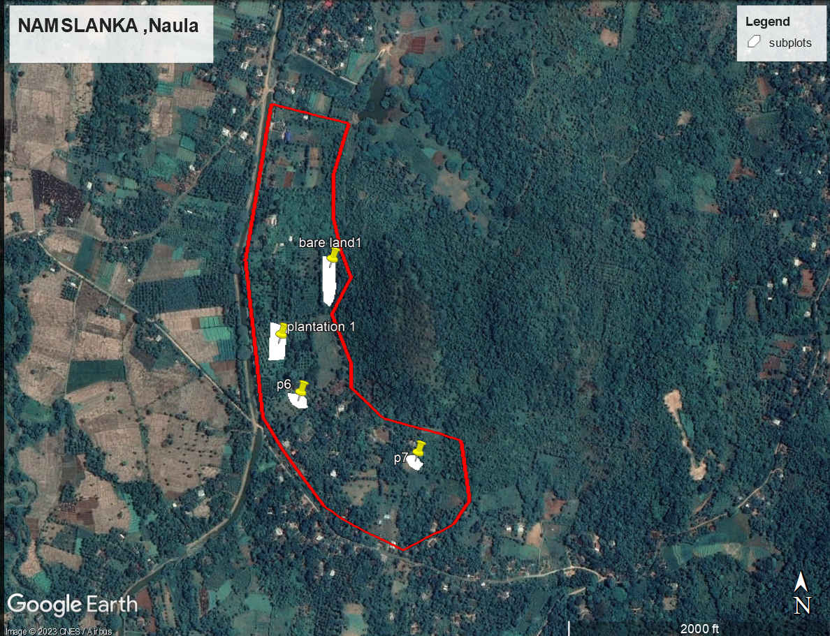
These indices, derived from Sentinel-2 satellite data, unlock a wealth of information crucial for understanding the dynamic interplay between vegetation health and moisture levels in the target region near Nams Lanka farm in Sri Lanka.

Insights and Applications:
-
Vegetation Monitoring: NDVI enables tracking of vegetation health and growth patterns, helping us understand how plant life responds to changing environments.
-
Crop Health Assessment: NDVI aids in agriculture by identifying stress, nutrient deficiencies, and diseases in crops, allowing targeted interventions for improved yield.
-
Land Cover Classification: NDVI contributes to mapping different land cover types like forests, grasslands, and urban areas, forming a basis for comprehensive land use assessments.
Temporal Resolution and Multi-Source Integration:
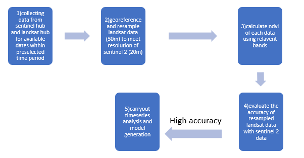
In our analysis, the temporal aspect is crucial due to Sentinel-2's five-day revisit cycle. This frequency allows us to track changes over time, capturing shifts in vegetation health and moisture content effectively.
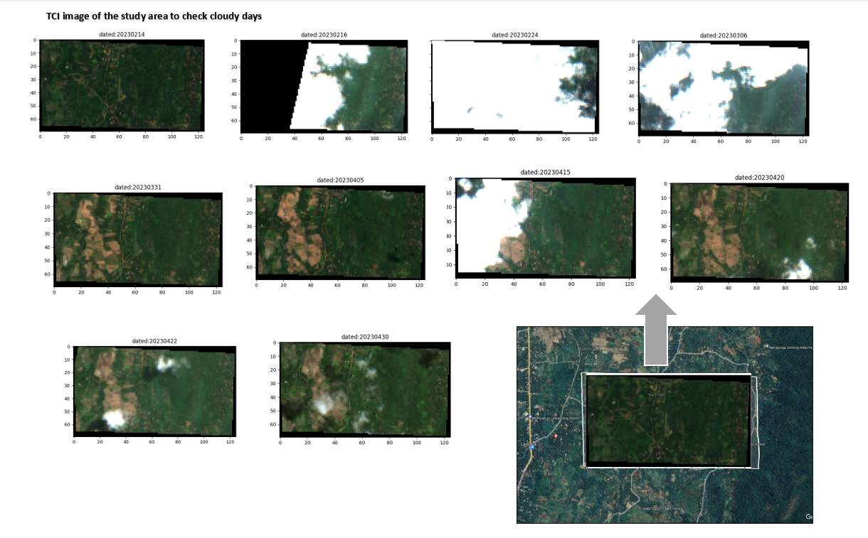
Moreover, to tackle cloud interference, we embrace a multi-source strategy. By combining data from Sentinel-2, Landsat-8, and MODIS, we fortify our analysis and improve observation accuracy.
Preprocessing methods, such as cloud cover classification using the Scene Classification (SCL) band and interpolating missing data, maintain dataset integrity and comprehensiveness.


In summary, our study leverages satellite-derived NDVI and NDMI indices, coupled with precise data handling and processing, to uncover the complex link between vegetation health and moisture content. This analysis provides valuable insights for irrigation management decisions, promoting sustainable practices and enhancing crop yields in the studied region.